


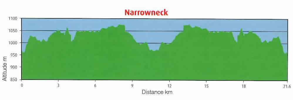
Distance
21.6km
Total Climbing
5.3km
Total Elevation
358m
Terrain
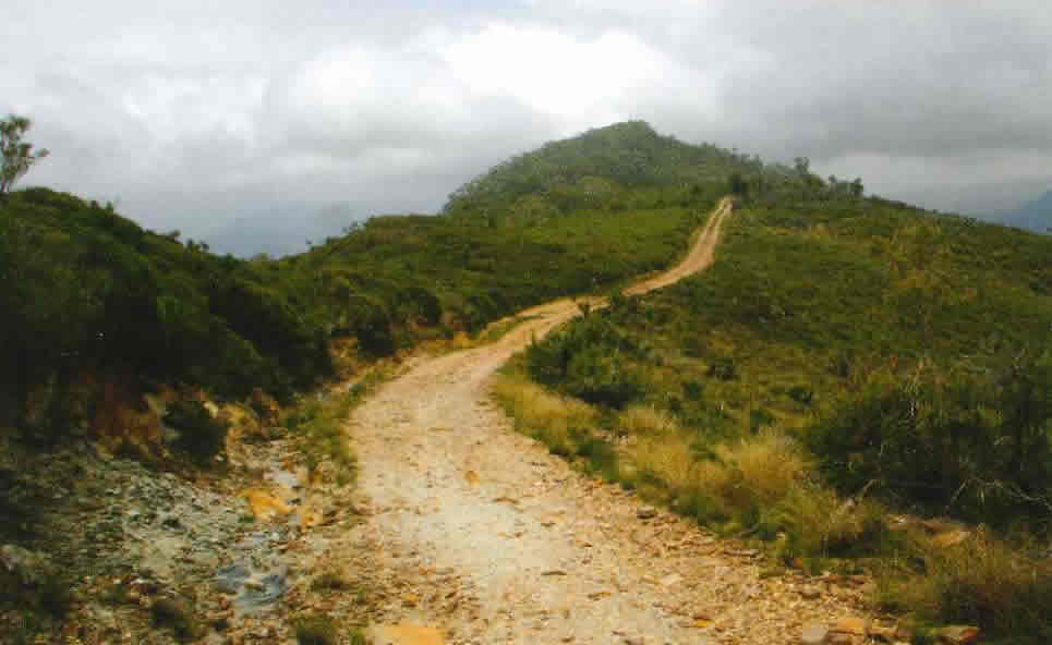
Predominately flat fire trail.
Traffic
Walkers and other Cyclists.
How to Get There
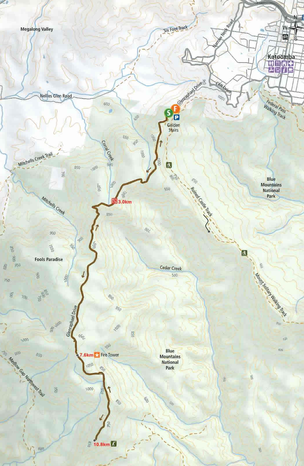
From Sydney take the M4 through to Katoomba and exit at ramp – turn left into Parke Street, left into Waratah, right at Katoomba Street, right at Katoomba Falls Road then follow Cliff Drive – turn left into Glenraphael Drive, follow this to the Golden Stairs car park and park there.
Food and Drink
No food or drink at trail head but plenty of funky cafes, restaurants and shops at Katoomba.
Side Trip
A walk on Golden Stairs, or a trip to the amazing Riuned Castle, and beyond to Mount Solitary.
About
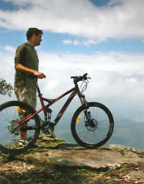
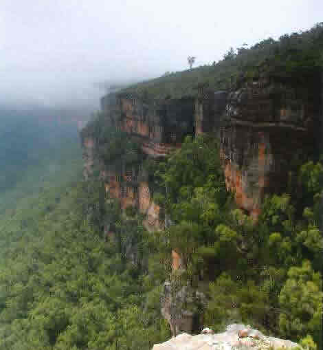
One of the most visually spectacular rides this 21km track follows the Narrowneck fire trail out along a narrow peninsular to a lookout offering fantastic views of the Grose Wilderness. Thanks to the stunted heath, the views are spectacular on both sides of the trail into both Megalong and Jamison Valleys. To top it all off, a good portion of the ride is on well graded fire trail, resulting in fun, high-speed cycling for most riders with moderate skill levels.
This ride is an “all you can eat buffet” of views from start to finish. From the first pedal stroke until the last, riders are surrounded by beautiful vistas of both the Jamison and Megalong valleys. The fantastic views are in part a result of the predominantly strong westerly winds experienced by the Narrowneck peninsular which causes a stunted heath vegetation community to predominate, offering almost 360 degrees unobstructed views,
At the end of the fire trail is a great lunch spot with views over the Grose Wilderness. To the south east on a clear day Lake Burragorang can clearly be seen in the distance. The keen walkers amongst you will be able to recognise the Mt Cloudmaker complex to the south with the Wild Dog Mountains in the fore ground. Out to the west are views of the Megalong Valley. Megalong is from an aboriginal word roughly meaning ‘valley beneath the rock’ and in the distance the Kanangra Walls can be seen. Views are often better here at dawn and dusk or on extremely windy days when the famous blue haze which gives the mountain range its name, caused by numerous eucalypt trees, is reduced.
Another interesting feature along the ride is the iconic Narrowneck fire tower which has been in operation since 1960. The tower is mostly used for fire spotting duties during the height of the fire season but is currently undergoing maintenance works as the years of exposure have not been kind to the original structure.
The ride itself is technically simple following a well graded fire trail. As the trail follows a plateau, it’s a relatively flat affair for most of its length. There is a bit of climbing with some very steep pinches but most are short in duration and can be walked. While the ride is suitable for almost anyone with basic off-road skills, caution is required on the steep descents and water bars, as they can catch you out. The section before the final lookout is also quite loose and eroded.
The old saying ‘if you don’t like the weather just wait 10 minutes’ rings true for this part of the world. Even in the wanner months the temperature can drop rapidly so cyclists be warned, come prepared with suitable clothing options. Narrowneck is exposed to the elements for the majority of the ride with little shade or wind protection, making this ride most suitable for autumn and spring. I rode this track on a mid summer’s morning enveloped in thick fog and a temperature in the single digits on the way out and then blazing sun and sweltering heat only a few hours later on the return!

0.0 From the Golden Stairs car park Lum left and follow fire trail.
3.0 Fire trail gates are reached, continue on around.
7.6 Fire tower is reached.
10.8 Lookout at the end of the trail is reached after enjoying the views. Return the same way back to Start.
21.6 Back at car park.

© 2016 Macquarie Chapel Presbyterian Church (MacChap)